
What We Do
Terrain Referenced Navigation
Terrain Referenced Navigation
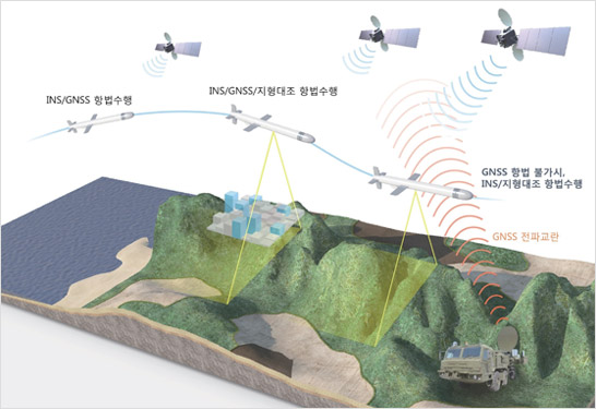
Terrain Referenced Navigation is a hybrid navigation technology which provides precision navigation solutions under GNSS (Global Navigation Satellite System) hostile environments.
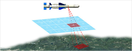
Undisturbed by radio interferences, the Terrain Referenced Navigation system is capable of estimating its location accurately and persistently over a long period of time by continuously surveying the AGL (Above Ground Level) altitude and comparing it to the terrain information database.
The system consists of: interferometric radar altimeter, navigation algorithm using non-linear filters, and parallel processing computer with high-speed computing capability. The system can be employed in all-weather conditions and, thereby, suitable for manned/ unmanned aerial vehicles and cruise missiles.